Upper Mustang Trek - 16 Days

Upper Mustang, Mustang District, Nepal
Sky crecker hill and flag
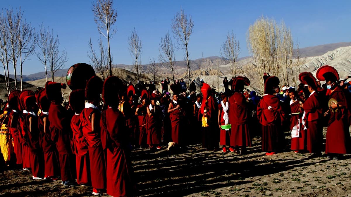
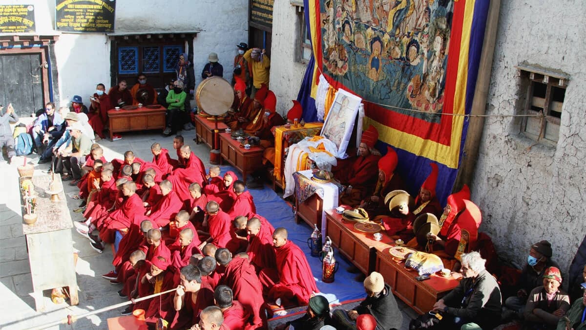
Upper Mustang Tiji Festival
Lo Manthang Tiji Festival Nepal
Duration16 Days
CountryNepal
Trip GradeModerate
i
Maximum Altitude3,800m
Group Size2 - 10
StartsKathmandu
EndsKathmandu
ActivitiesUpper Mustang Trekking
Best TimeLate March to Mid November

There are places in Nepal you visit principally for mountains. Upper Mustang asks you to pay attention to something else.

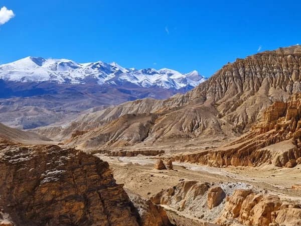
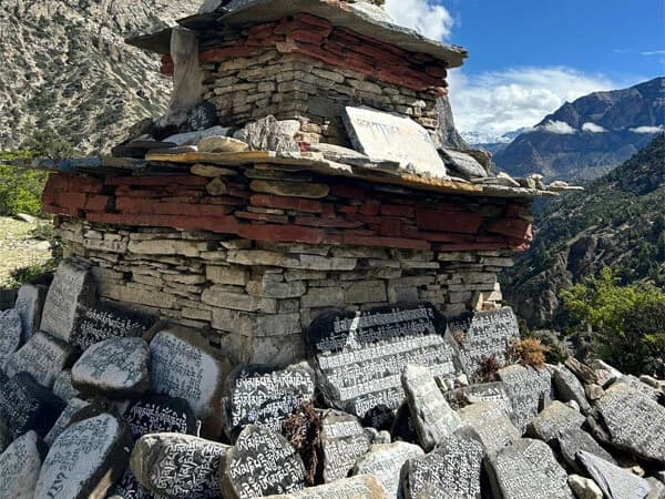
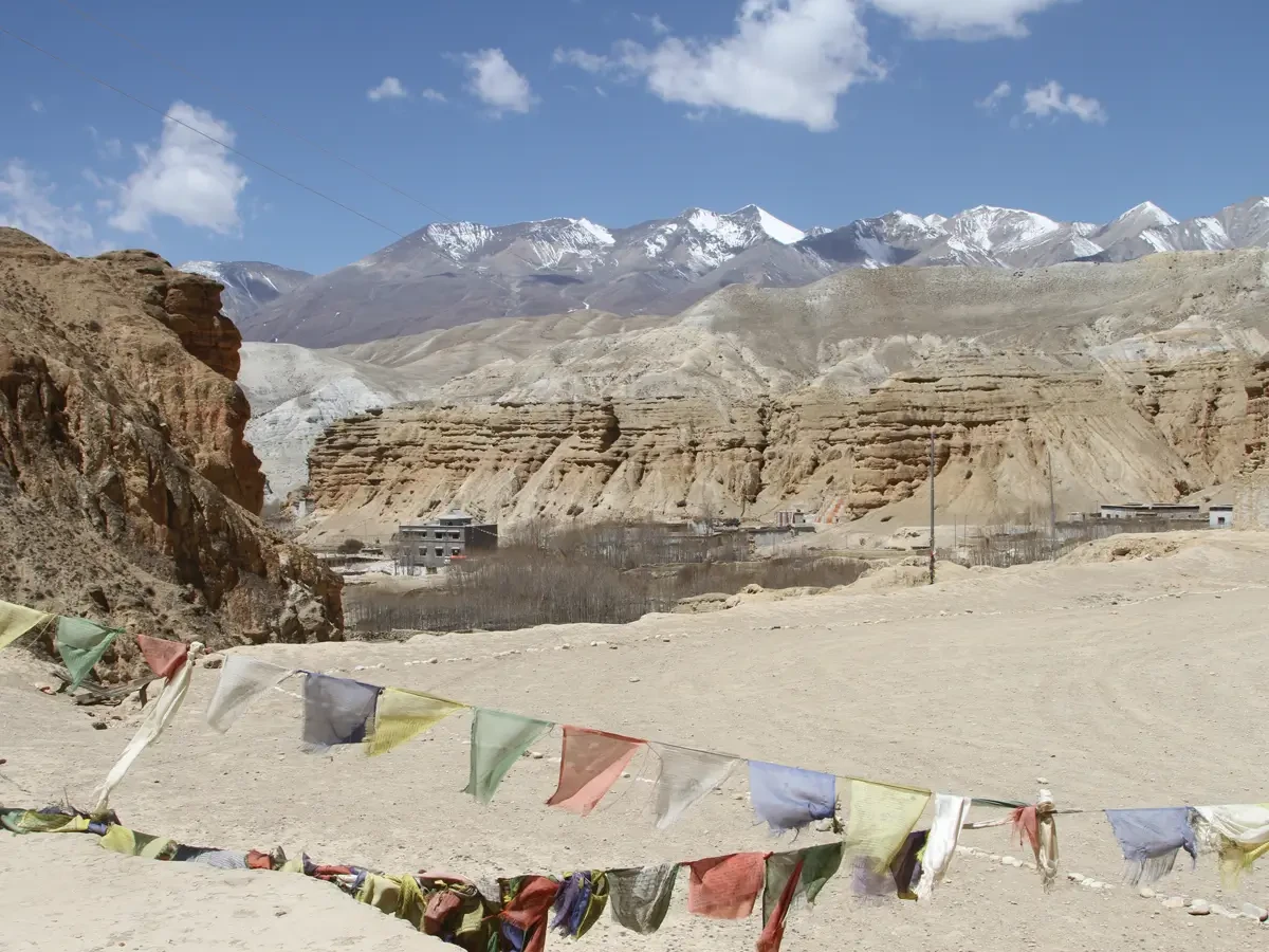
Beyond Kagbeni, the landscape opens into a high, dry country of wind-cut cliffs, broad valleys and villages gathered around the few places where water makes cultivation possible. Chortens mark the entrances to settlements. Mani walls run beside the trail. Monasteries rise among earth-built houses. Horses still make sense in a landscape where communities are separated by long stretches of open ground.

The farther north you walk, the more these details begin to connect.

Lo Manthang is the cultural centre of the journey, but reaching it is only part of what makes the trek worthwhile. The days before it introduce the geography and village life of Upper Mustang gradually; the time spent in Lo Manthang and Chhoser brings its Buddhist heritage, monasteries and old settlement patterns into focus; and the route afterwards turns away from the more direct return, continuing through Dhi, Yara, Tangye and Tetang before crossing toward Muktinath. Muktinath and Kagbeni are the gateway to Lo Manthang but ending point of the Annapurna Circuit trek.

This is not a trek designed simply to deliver you to a famous place as quickly as possible. It gives you time to understand where you are walking, why settlements developed where they did, how religion remains visible in everyday spaces and why festivals, horses, monasteries and cultivated fields still belong naturally to this landscape.

There is physical substance too. The eastern return contains longer and more demanding walking days, including the Tangye-Tetang crossing, so the journey does not become a sightseeing tour once Lo Manthang has been reached. It remains a proper Himalayan trek, just one where cultural understanding matters as much as altitude.

For travelers who have already learned that the most rewarding journeys are not always the fastest or the highest, Upper Mustang offers something more considered: sixteen days to enter a place gradually, understand it better and leave by a different route than the one that brought you in.

Why Choose This Upper Mustang Trek?

Today, there is a road to Lo Manthang. That makes an important question unavoidable:

Why walk?

Because getting there quickly and understanding the place slowly are two different kinds of journey.

Walking north from Kagbeni gives Upper Mustang time to unfold. One village leads to another rather than appearing through a windscreen. You notice where irrigation turns brown ground green. You pass religious structures before you know their names. Dhakmar's red cliffs arrive as a change in the landscape rather than as another photo stop. By the time Lo Manthang appears below Lo La, you have spent several days approaching the place that gives the journey much of its meaning.

Then the route changes. It does not simply retrace the same approach. After Lo Manthang and Chhoser, the trail turns through Dhi and Yara and continues into the longer eastern stages through Tangye and Tetang. Settlements become farther apart. The walking becomes more serious. The cultural density around Lo Manthang gives way to wide, exposed country before the route finally crosses toward Muktinath.

The journey has a clear progression:

approach slowly → understand Lo Manthang → walk through Chungsi Cave → Lo Ghekar the quieter side of Mustang.

For someone prepared to give Upper Mustang sixteen days, that is a much stronger reason to choose this itinerary than simply being able to say you reached Lo Manthang.

Upper Mustang Route at a Glance

Kathmandu → Pokhara → Jomsom → Kagbeni → Chele → Syangboche → Dhakmar → Charang → Lo Manthang → Chhoser → Dhi → Yara → Tangye → Tetang → Muktinath → Jomsom → Pokhara → Kathmandu

The trek enters the restricted Upper Mustang area beyond Kagbeni and works progressively north toward Lo Manthang.

The return is where this itinerary separates itself from a simple there-and-back route. Rather than following the principal approach south again, it turns east through Yara before the long stages to Tangye and Tetang.

There are roads in Upper Mustang now and some trekking sections encounter or use motorable tracks. This should not be marketed as sixteen days of roadless wilderness. The value lies in the complete walking journey and particularly in the much quieter eastern return.

The Experiences That Give This Trek Its Character

Crossing beyond Kagbeni. The change is immediate enough to notice but gradual enough to enjoy. Villages, cultivation and religious landmarks become increasingly concentrated inside a much drier landscape.

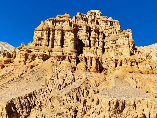
Dhakmar's red cliffs. Mustang's geology changes colour dramatically here. The settlement sits beneath red and ochre formations that look quite different from the pale slopes of earlier days.

First sight of Lo Manthang. The approach over Lo La is more rewarding because the city has been approached over several days rather than reached in a morning's drive.

Two nights around Lo Manthang. The extra day allows Chhoser and the cave settlements to become part of the journey instead of squeezing Lo Manthang into an arrival-and-departure schedule.

The Yara-Tangye-Tetang circuit. This is where the trek changes character. Services become fewer, distances increase and the landscape begins to dominate again.

The transition to Muktinath. After several quieter eastern stages, Muktinath introduces a completely different atmosphere: pilgrims, trekkers and a sacred landscape shared by Hindu and Buddhist traditions.

Lo Manthang: The Cultural Heart of the Journey

You first see Lo Manthang from above.

After the climb toward Lo La, the walled settlement appears across the plateau below, compact, earth-coloured and surprisingly contained within the scale of the surrounding landscape. Reaching it feels important. Staying long enough to look beyond the walls matters more.

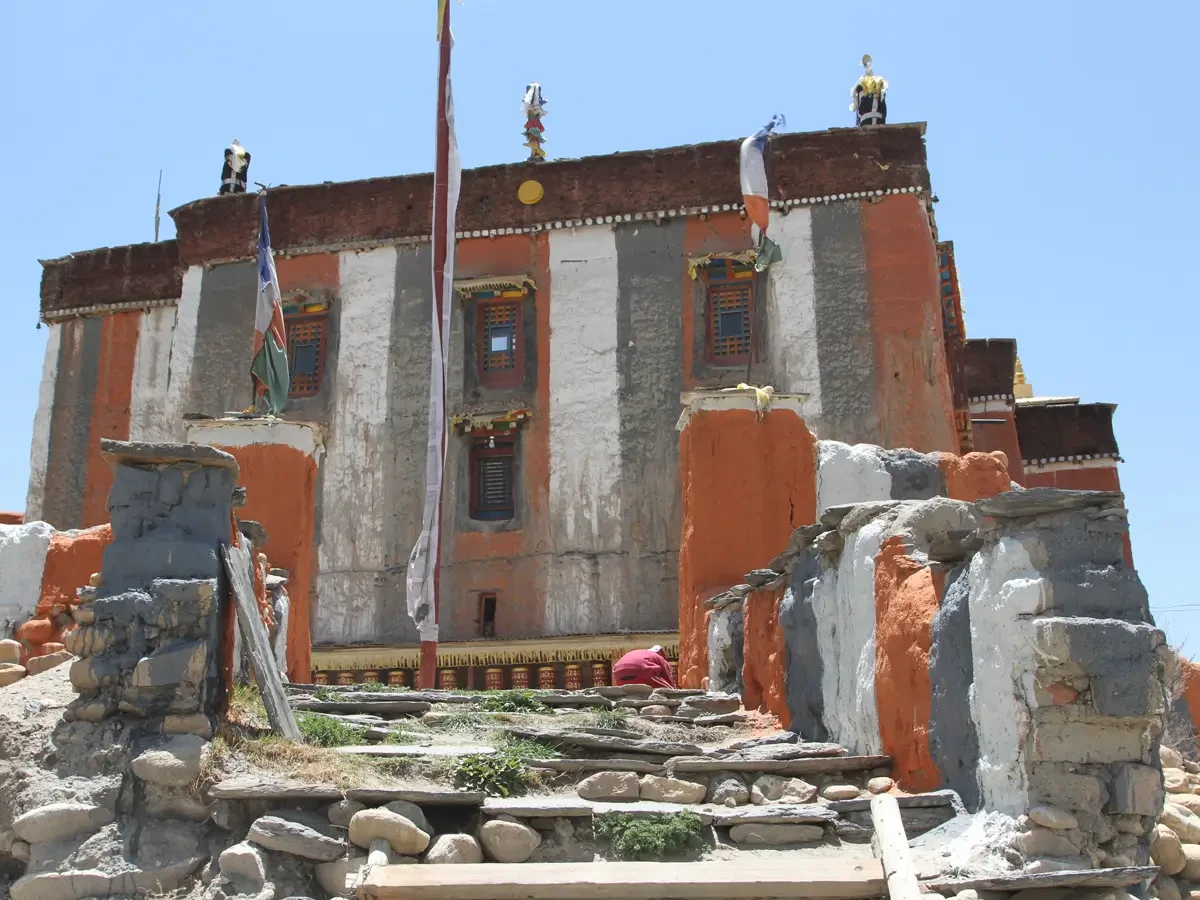
Inside, narrow lanes lead between houses, religious buildings, chortens and courtyards. Jampa and Thubchen belong to the important fifteenth-century religious architecture of the settlement, while Choede was established later. The former Kingdom of Lo also occupied a strategic position on the old Kali Gandaki trade route linking areas south of the Himalaya with the Tibetan plateau.

The traveler does not need a lecture on arrival. What matters is having enough context that the town begins to make sense. Why is this monastery important? Why do chortens appear where they do? Why do people move around sacred structures in a particular direction? How did religion, trade, agriculture and political authority coexist inside such a small settlement?

A knowledgeable guide can turn those questions into the difference between looking at Lo Manthang and actually beginning to understand it. That is one of the strongest reasons to spend two nights here. Lo Manthang is historically important. But it is not a museum.

Understanding the Buddhist Landscape of Upper Mustang

Buddhism is visible long before you reach Lo Manthang. It appears in chortens at village entrances, mani stones beside the trail, prayer flags on exposed ground and monasteries built into the physical life of settlements. Yet describing all of Upper Mustang simply as "Tibetan Buddhist" misses part of what makes the region interesting.

Lo Manthang and the Sakya Tradition

Lo Manthang has particularly strong historical connections with the Sakya tradition of Tibetan Buddhism. For a visitor, knowing that much is enough to begin seeing the town differently. The monasteries cease to be interchangeable "old gompas." Religious architecture, paintings, ritual spaces and festivals begin to belong to a larger living tradition.

Where Nyingma Fits Into Mustang's Story

Mustang's Buddhist heritage is broader than one school.

Lo Gekar, or Ghar Gompa, is traditionally connected with Padmasambhava, Guru Rinpoche, whose role is especially important in the Nyingma tradition.This does not mean we should call Upper Mustang a "Nyingma region," nor should we promise Lo Gekar as part of this itinerary unless Global Eco Trails confirms that its Day 7 operating route actually goes via Mui La and Ghar Gompa.

The distinction is more useful; Lo Manthang has a strong Sakya identity, while the wider religious landscape of Mustang contains different histories, institutions and Buddhist lineages. A traveler does not need to arrive knowing any of this. A good Upper Mustang journey should make them curious enough to want to know.

Festivals Worth Planning a Journey Around

Upper Mustang's festivals should not be treated as decorative additions to a "Best Time" paragraph. For the right traveler, they can determine when the entire journey should take place.

Tiji: When Lo Manthang Changes Character

On an ordinary day, Lo Manthang can feel restrained. During Tiji, the same spaces fill with ritual movement, music, monks and people arriving to participate or observe.

Tiji, also called Tenchi, is a Buddhist religious festival associated with Vajrakila practice. For visitors, the masked dances are the most immediately visible element. But the more interesting experience begins when you understand that they are not staged entertainment created for tourists. The monastery community is performing a religious tradition in the place to which that tradition belongs. That changes how you watch. A traveler genuinely interested in Tiji should choose a festival-timed departure, not merely "travel in May." The dates follow the religious calendar and should be reconfirmed for the intended year. Talk Our Experts about the festival date.

Global Eco Trails already has a separate Tiji Festival product, which should be internally linked here rather than trying to make every spring departure sound like a festival trip.

Yartung: Mustang on Horseback

Late summer brings a very different atmosphere.

Yartung is a multi-day seasonal celebration associated with the end of summer in Upper Mustang. Horse racing, riding skills, singing, dancing, eating, drinking and religious observance come together around Lo Manthang.

For an outsider, the races are immediately compelling. Dust rises behind the horses. Riders push hard across open ground. People gather around the course. A landscape that often feels expansive and quiet suddenly has speed in it. But Yartung becomes more interesting once you have already walked through Mustang. The horses do not feel like festival props. They belong to a high plateau where mobility, trade and distance have shaped everyday life for generations.That connection between spectacle and place is precisely what makes the festival worth seeing.

Is This Upper Mustang Trek Right for You?

This trek suits travelers who want the journey itself to carry meaning.

You should be able to walk comfortably for six or seven hours on successive days and accept that a few stages are longer. You do not need technical climbing experience, but you do need stamina, steady footing and the willingness to spend a full day on the trail when the route demands it.

It is particularly rewarding if you value: time in villages rather than rushing between headline attractions; cultural explanation rather than merely photographing monasteries; a quieter return route after Lo Manthang; and the satisfaction of completing a substantial trek without making altitude the sole measure of achievement.

It is less suitable if your main aim is to reach Lo Manthang as efficiently as possible. For that traveler, Global Eco Trails' Upper Mustang Overland Tour - 10 Days is the more logical product. That is not an inferior way to visit. It is simply a different way to travel.

Itinerary

16-Day Upper Mustang Trek Itinerary

Distances and walking times are approximate. Trail choice, lodge location, weather, road use and individual pace can change the exact figures. "Max Altitude" should mean the highest elevation physically reached during the day, not simply the sleeping altitude.

Trip PlanExpand All
01Day

Meet the Global Eco Trails representative at the airport and transfer privately to your hotel.

There is deliberately little scheduled today. After a long international journey, an uncomplicated arrival is more valuable than filling the afternoon with compulsory sightseeing. Use the remainder of the day to rest, organise trekking equipment and adjust to Kathmandu.

Activity: Airport transfer

Max Altitude: 1,350 mAccommodation: Hotel in Kathmandu
02Day

Leave Kathmandu for Pokhara by tourist bus.

This is primarily a transport day. The road follows river valleys westward toward Pokhara, but driving time can change considerably with traffic, construction and highway conditions.

A relaxed evening in Pokhara gives you time to repack before the mountain flight into Jomsom.

Max Altitude: 830 mMeals: BreakfastAccommodation: HotelDuration: 8 hoursDistance: 200 km
03Day

The flight into Jomsom brings you quickly into the Kali Gandaki valley. From here, the trek begins gently with the walk north to Kagbeni.

Do not treat Kagbeni merely as the night before Upper Mustang. Its compact old settlement, chortens, prayer stones and position at the meeting of the Kali Gandaki and Kag rivers make it a useful cultural transition between Lower and Upper Mustang.

Max Altitude: 2,810 m /9,219 ft.Meals: Lunch and DinnerAccommodation: Guest HouseDuration: 3 hoursDistance: 10 km
04Day

Today the trek moves beyond Kagbeni into the restricted Upper Mustang area. Follow the Kali Gandaki north past villages and small areas of cultivation where barley, buckwheat and fruit trees interrupt the dry valley.

Tangbe gives an early sense of the relationship that will define much of the trek: fields and houses gathered where water can be controlled, with much larger expanses of bare land surrounding them. Continue to Chele for the night.

Max Altitude: 3,050 m / 10,007 ftMeals: Breakfast, Lunch, and DinnerAccommodation: Guest HouseDuration: 6 hoursDistance: 15.3 km
05Day

The profile becomes more broken today.

Cross Taklam La at approximately 3,624 m and Darjori La around 3,735 m, moving through a landscape of eroded cliffs, small caves and increasingly open high ground before reaching Syangboche.

The distance is moderate, but repeated ascent and descent make this a more substantial day than the kilometer figure suggests.

Max Altitude: 3,800 m / 12,467 ftMeals: Breakfast, Lunch, and DinnerAccommodation: Guest HouseDuration: 6 hoursDistance: 11 km
06Day

Continue across the Mustang plateau, crossing Yamada La around 3,850 m before descending toward Dhakmar. The landscape changes noticeably near the village. Red cliffs rise behind the settlement, bringing stronger colour into terrain that has often been pale grey, brown and ochre until now. It is one of those days when the destination matters visually as much as the walk itself.

Max Altitude: 3,850 m / 12,631 ftMeals: Breakfast, Lunch, and DinnerAccommodation: Guest HouseDuration: 6 hoursDistance: 12 km
07Day

This is the most scenic and culturally significant day of the Lo Manthang Trek. From Dhakmar, the trails climbs accross the high Mustang landscape to Mui La at Approx. 4,170 m with wide view over the dry valleys and surrounding ridge.

Continue to Lo Gekar, or Ghar Gumba, an important buddhist sites traditionally associated with Padmasambhava. After spending some time at monastery, descend through the open plateau and valley landscape to ward Charang for a night.

Max Altitude: 3,560 m / 11,680 ftMeals: Breakfast, Lunch, and DinnerAccommodation: Guest HouseDuration: 6 hoursDistance: 11 km
08Day

This is the day Lo Manthang comes into view.

After leaving Charang, the route climbs gradually toward Lo La at approximately 3,965 m. From the pass, the walled settlement can finally be seen across the plateau. Because you have spent several days approaching it, the first sight carries more weight than it would from a vehicle. Descend into town and resist the temptation to turn the afternoon into a checklist. There is another full day here.

Max Altitude: 3,965 m / 13,009 ftMeals: Breakfast, Lunch, and DinnerAccommodation: Guest HouseDuration: 6 hoursDistance: 11 km
09Day

Day Trip to Chhoser Cave or Konchok Ling Cave (3,770 m / 12368 ft) – 7 hrs

Today is not a rest day in the conventional sense. It is a day for feel and understanding why Lo Manthang was worth walking to!

Explore the town's monasteries and then travel north toward Chhoser, where cave complexes and religious sites reveal another way people have used the cliffs and landscape of Upper Mustang.

Jhong Cave is the standard focus in the current itinerary; longer excursions should remain optional because route conditions and access can change.

There is no advantage in trying to see everything. The better experience is to see fewer places with enough explanation that they remain distinct in your memory.

Max Altitude: Route dependent; confirm the day's exact Chhoser program

Walking / Exploration Distance: Approx. 10-15 km

Activity Time: Approx. 6 hrs

Meals: Breakfast, Lunch and Dinner

Accommodation: Guesthouse / Teahouse

Max Altitude: 3,810 mMeals: Breakfast, Lunch, and DinnerAccommodation: TeahouseDuration: 7 hoursDistance: 10-15 km
10Day

Leaving Lo Manthang does not mean the interesting part is behind you.

The route turns toward Dhi and Yara, beginning the eastern side of the circuit. Cross high ground before descending sharply toward Dhi, then continue through the valley toward Yara.

The change is subtle at first, but it matters: the villages become less frequent, the trail feels less like a sequence of recognised Upper Mustang stops and the following days require greater self-sufficiency.

Max Altitude: 3,950 m / 12,959 ftMeals: Breakfast, Lunch, and DinnerAccommodation: Guest HouseDuration: 8 hoursDistance: 16 km
11Day

As you step onto the trails from Yara to Tangye, you will hear the whispering wisdom of the Himalayas in the thin air along the journey. The barren, rugged landscape spreads like paint on a boundless canvas. The uninhabited trails, with constant ascents and descents, give you enough time to understand yourself, as there are no houses or settlements along the way. Crossing the Dhechyang Kholla valley, with Kaligandaki River winding in its path, human melody waits in the Tangye village where Tangye horses, chortens, mani walls, and warm welcoming people melts your heart.


Max Altitude: 4015 m / 13,169 ft.Meals: Breakfast, Lunch, and DinnerAccommodation: Guest HouseDuration: 9 hoursDistance: 18 km
12Day

You have to set off early today as it is a long haul of a 9-hour trek from Tangye to Tetang in the Upper Mustang area. Along the way, you will walk between the barren beauty of towering cliffs, rugged mountains, snow-peaked Himalayas, rivers nearby villages. The trail will lead you to Pa (4200 m / 13,776 ft.), the best scenic viewpoint in Upper Mustang trekking. With the topography of high and lows, you move along the rhythm of Pa, watching the abandoned settlement whisper its stories. From here, your path continues to ascend to the Siyarko Tank Danda route with challenging climbs along with the majestic views of the Himalayas. After more walking, you will reach Chhomnang, where you will stumble upon a fascinating Himalayan salt mine. After this much-awaited promise, you finally reach ancient Tetang village.

Max Altitude: 4200 m / 13,776 ft.Meals: Breakfast, Lunch, and DinnerAccommodation: Guest HouseDuration: 9 hoursDistance: 24 km
13Day

Today, you are trekking over Tetang, Gyu Lo Pass (4,077 m / 13,376 ft), and Jhong which leads your Upper Mustang trek to Muktinath. Every day offers different surroundings and beautiful views of mountains and landscapes. Along the way, you can see the Throng la (5,416 m) pass of Annapurna Circuit Trek and join Muktinath. Muktinath is very famous for its religious significance, where both Hindus and Buddhists worship together in the Temple and Monastery.

Optional: Upon arrival in Muktinath, you can look around the area and take a jeep to Jomsom, which is 22km / 2 hrs away. Stay overnight at Jomsom, and the next morning fly back to Pokhara.

Max Altitude: 4,077 m / 13,376 ftMeals: Breakfast, Lunch, and DinnerAccommodation: Guest HouseDuration: 7 hoursDistance: 14 km
14Day

The final full walking day follows the Kali Gandaki corridor toward Jomsom.

Although predominantly downhill, approximately 22 km still makes this a substantial day. If accumulated fatigue makes the full walk unappealing, the current package notes that local vehicle support may be used between Muktinath and Jomsom for a sharing.

That option should be explained as flexibility, not failure.

Max Altitude: 3,800 m / 12,467 ftMeals: Breakfast, Lunch, and DinnerAccommodation: Guest HouseDuration: 6 hoursDistance: 22 km
15Day

Walk to Jomsom Airport for the scheduled morning flight to Pokhara and continue to Kathmandu when the day's flight operation and connection permit. This is one place where good trip planning matters more than attractive wording.

Jomsom flights are weather and visibility dependent. If they cannot operate, an overland alternative may be necessary and the exact solution depends on road conditions, vehicle availability and the remaining schedule.

Travelers should avoid placing an inflexible international departure immediately behind a weather-sensitive mountain itinerary. Evening farewell.

Max Altitude: 1,350 m / 4,480 ft.Meals: Breakfast and farewellAccommodation: HotelDuration: 45 minutes
16Day

Transfer to the airport for your onward flight.

By now Upper Mustang should feel less like a single destination called Lo Manthang and more like a sequence of places that gradually explained one another.

Meals: Breakfast
Did not find what you are looking for?Reach out to our travel experts.
Customize Trip

Cost Details

Includes

  • Airport pick up and drop off services in Kathmandu.
  • 2-night accommodation in Kathmandu at 3*** hotel including breakfast.
  • Upper Mustang Restricted Area Special Permit
  • Annapurna Conservation Entry Permit
  • TIMS (Trekkers Information Management System) permits
  • 12-night twin sharing Mountain accommodation
  • All meals (Breakfast, Lunch and Dinner) as per itinerary
  • Kathmandu to Pokhara by comfortable Tourist Bus
  • Pokhara to Jomsom to Pokhara by flight.
  • Pokhara to Kathmandu return by flight
  • An Experienced English-Speaking Guide with equipment.
  • All the food and lodging and salary of Sherpa Guide
  • Insurance of Nepalese Staff.
  • 1-night, 3** stars hotel in pokhara including Breakfast
  • All ground transportation as per itinerary
  • Gov't tax and VAT
  • The services which are not mentioned in the included section are extra

Excludes

  • Personal expenses, Tipping to the Guide,
  • Necessary trekking equipment
  • Pony trek is available but the cost of Pony is solo responsible
  • Lunch and Dinner during Kathmandu and Pokhara.
  • Extra night accommodation in Kathmandu and Pokhara because of early arrival, late departure, early return from mountain (due to any reason) than the scheduled itinerary
  • Lunch and evening meals in Kathmandu and Pokhara (and also in the case of early return from the mountain than the scheduled itinerary)
  • Taking a porter will cost additional 25 USD per day (ratio:- 1 porter is for every 2 clients, 1:2) including his all expenses

Dates & Availability

We run a trip for solo travelers, couple, friends and family with children. Our private trips are running every day. If you are looking for group trips please do contact us. Out Itinerary is outline and if you any suggestion, we are happy to customize in the itinerary and services.

Add-ons & Options

Porter Services: The mark price do not includes the porter services. If you need a porter please feel free to let us know. Taking a porter will cost additional 350 USD. (ratio:- 1 porter is for every 2 clients, 1:2) including his all expenses

Pony Services: Upper Mustang is popular for pony services as well. If you would like to have a horse riding to explore the area that will cost you additional (50 to 100) USD depending on the season.

Essential Information

Upper Mustang Trek Difficulty and Fitness

The route is best understood as Moderate to Challenging. Altitude is lower than on many of Nepal's high-pass treks, but altitude alone does not determine difficulty.This itinerary includes repeated five- to seven-hour days, dry and exposed terrain, frequent ascent and descent, passes around 4,000 m, an approximately 18 km Yara-Tangye stage and a scheduled 24 km / roughly nine-hour Tangye-Tetang day.

What Is the Hardest Day?

Tangye to Tetang is the physical benchmark.

The published route covers approximately 24 km and around nine hours, reaching Pa at roughly 4,200 m before continuing across exposed terrain toward Tetang.

If nine hours on foot sounds considerably beyond your normal walking range, discuss pacing or route alternatives before booking, not after reaching Tangye.

Do I Need to Be an Experienced Trekker?

You do not need mountaineering experience.

You should, however, arrive comfortable with long hill walks and consecutive active days. Regular hiking, stair climbing, moderate cardiovascular training and strength work for legs and core in the months before departure will be considerably more useful than simply trying to "get fit" at the last moment.

What About Altitude?

The route high point is approximately 4,200 m, while Lo Manthang itself sits around 3,800 m.

The itinerary climbs progressively through Mustang rather than jumping directly to the highest point, but it does not include a formal dedicated acclimatization day early in the trek.

Altitude symptoms should therefore be taken seriously even though the trek remains lower than Everest Base Camp or Nepal's major 5,000 m passes.

Dates, Price and Private Departures

Global Eco Trails currently sells this trek with group-size pricing and also states that private departures can operate for solo travelers, couples, friends and families.

For this audience, the page should place particular emphasis on private and small-group departures, because that allows more flexibility in pacing, guide attention and cultural interpretation.

(1-1) Traveler ----US$2,500/ 

(2-4) Traveler----US$1999/

(5-8) Traveler---- US$1735/

(9-12) Traveler--- US$1599/

Best Time for the Upper Mustang Trek

Upper Mustang follows a different seasonal logic. Mustang lies north of the main Himalayan barrier in a rain-shadow zone, so it receives substantially less summer monsoon precipitation than areas on the southern side of the mountains.

Late March to May - Spring and Tiji Season

Spring brings the return of the main trekking season after winter. For travelers interested in Buddhist culture, this period is particularly important because Tiji normally falls in spring, write us for exact dates for Tiji festival which will be based on Tibetan calendar.

Choose a dedicated Tiji departure if the festival is central to your decision. Your arbitrary booking may not suit your desire to experience tiji.

June to August - The Monsoon Alternative

While heavy monsoon rain affects much of Nepal, Mustang's rain-shadow position means trekking can remain viable but it does not mean every day is guaranteed dry, most of the time is dry. 

Kathmandu, Pokhara, roads and flights outside the rain shadow can still be affected by monsoon conditions.

For travelers whose annual schedule makes summer the easiest time to travel, Upper Mustang is one of Nepal's most logical major trekking options. Late summer may also offer the possibility of timing the journey around Yartung.

September to Mid-November - Autumn

Autumn remains one of the most straightforward periods for the trek.

Conditions tend to be cooler after the monsoon, trekking services are operating normally and the season suits travelers who want Upper Mustang without deliberately targeting a major festival.

December to February - Winter

Winter is a different proposition in Mustang.
The route remains geographically possible, but cold intensifies, daylight shortens, and some local businesses may close or operate more limited services.
For this particular 16-day lodge-based circuit, winter should be discussed with global eco trails before booking this trip.

Accommodation: What Should You Realistically Expect?

Accommodation changes as the route changes.

While in Kathmandu, we provide a three star hotel accommodation including modern facilities and two stars in Pokhara.

On the trek, nights are spent primarily in local guesthouses and teahouses with good facilities.

Larger settlements such as Jomsom and Lo Manthang generally provide attached bathroom facility. On the eastern return through Yara, Tangye and Tetang, facilities are limited and alternatives fewer. That does not make these nights undesirable.

It simply means the traveler should arrive with the correct expectation.

A clean room, warm meal and competent host matter more here than hotel-style amenities. Twin sharing is the normal package arrangement unless otherwise confirmed.

Meals, Water and Long Walking Days

Breakfast, lunch and dinner are included on the mountain trekking section according to the current package structure. Menus are naturally broader in larger settlements and narrower in remote villages.

On stages such as Yara-Tangye and Tangye-Tetang, will be a mountain lodge and restaurant may have limited food options. Food and sufficient water will be organizes by Global Eco Trails.

Upper Mustang Permits and Guide Requirements

Upper Mustang remains a Restricted Area and a special permit and Annapurna Conservation Entry Permits are required.

Restricted Area Permit

The Upper Mustang Restricted Area Permit is currently: USD 50 per person per day.

The permit is handled by trekking-agency process.

Can a Solo Traveler Trek Upper Mustang?

The permit framework changed in March 2026 so that a single trekker can now be processed under the restricted-area system through a government-registered agency with the required guide arrangement.

The important note:- solo traveler does not mean unguided independent trekker.

TIMS - Trekkers Information Management Systems

The Upper Mustang Trek currently falls under the revised TIMS system requiring the appropriate trekking-agency-issued TIMS card and licensed guide arrangement.

Annapurna Conservation Area Permit (ACAP)

The current permit structure is:

NPR 3,000 for foreign nationals

NPR 1,000 for SAARC nationals.

Jomsom Flights, Roads and Why Flexibility Matters

The flight between Pokhara and Jomsom saves a huge amount of road travel time. But it is also weather dependent. Visibility, wind and operational decisions can disrupt mountain flights. If a flight cannot operate, Global Eco Trails will reorganise alternative transport as per necessary.

Upper Mustang is no longer a completely roadless trekking region. Vehicles can reach Lo Manthang and trekking routes encounter roads or tracks in places.

That does not remove the reason to trek.

It changes it.

The strongest argument for this itinerary is no longer "this place can only be reached on foot."

It is: walking allows you to experience the distance, progression and relationship between settlements in a way that driving cannot. This particular route also continues into the quieter Yara-Tangye-Tetang circuit after Lo Manthang. That is a stronger claim because it remains true.

Speak to our Expert
Krishna Dahal
Krishna Dahal
+977 9841485631

You May Also Like

Upper Mustang Trekking from Ghami
12 Days
12

Upper Mustang Tiji Festival - 12 Days

Upper Mustang
1 review

$2300USD$2500 USD
Upper Mustang Overland Tour
10 Days
12
6

Upper Mustang Overland Tour - 10 Days

Mustang
1 review

$1350USD$2100 USD
Need Help? Call Us.+977 9841485631